En
Log in
All resources
Create a design
Tools
7,118 Free Images of Engraved Maps
copper engraving print
british library
joan blaeu
atlas maior, vol 3 (germany) - joan blaeu, 1667 - bl 114.h(star).3
maps from the earth and its inhabitants, vol. vii
atlas maior, vol 4 (netherlands) - joan blaeu, 1667 - bl 114.h(star).4
baroque
national library of poland
maps from the earth and its inhabitants, vol. x
maps from the earth and its inhabitants, vol. xv
maps from encyclopædia britannica
emery walker
maps of bologna by braun & hogenberg
maps in the british museum
engravings of topographia palatinatus rheni
baroque
liber qvartvs contrafactur vnd beschreibung von den vornembsten stten der welt (zzk 0.32)
patrimonium 2 (project)
victor levasseur - maps of france
baroque
maps from the earth and its inhabitants, vol. v
denmark in the 19th century
illiteracy in france
education in france
maps from the earth and its inhabitants, vol. ii
st malo
maps from the earth and its inhabitants, vol. x
canals in egypt
maps from the earth and its inhabitants, vol. xv
flora of canada
maps from the earth and its inhabitants, vol. vi
charles eugène perron
maps from the earth and its inhabitants, vol. xv
flora of alaska
maps from the earth and its inhabitants, vol. xiv
maps of the southern ocean
old maps of syracuse
pierre-adrien pâris
renold elstracke
renaissance
maps from the earth and its inhabitants, vol. vii
targot mountains
maps from the earth and its inhabitants, vol. xiii
mount kenya
maps from the earth and its inhabitants, vol. xvi
surveying in mexico
maps from the earth and its inhabitants, vol. xvii
french louisiana
maps from the earth and its inhabitants, vol. x
lake tana
maps from the earth and its inhabitants, vol. ix
adana
maps from the earth and its inhabitants, vol. vi
pyatigorsk
maps from the earth and its inhabitants, vol. viii
ghats
maps from the earth and its inhabitants, vol. vii
yarlung tsangpo
maps from the earth and its inhabitants, vol. xv
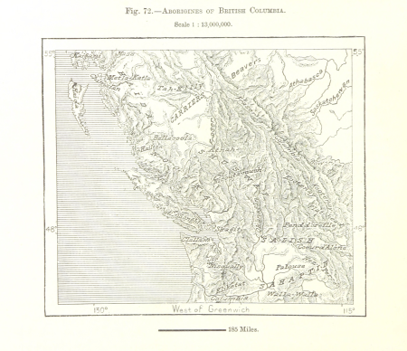
first nations people of british columbia
maps from the earth and its inhabitants, vol. viii
british india
maps from the earth and its inhabitants, vol. x
rosetta (egypt)
maps from the earth and its inhabitants, vol. vii
qinghai lake
maps from the earth and its inhabitants, vol. xviii
transport in south america
maps from the earth and its inhabitants, vol. xvi
jorullo
mercator 1587 world map
maps by jodocus hondius
cornelis de jode
1579 maps
liber qvartvs contrafactur vnd beschreibung von den vornembsten stten der welt (zzk 0.32)
patrimonium 2 (project)
cartography
maps
engravings of topographia braunschweig lüneburg
baroque
maps of wallachia by gerardus mercator
maps by willem and johannes blaeu
maps from the earth and its inhabitants, vol. vii
ebi lake
maps from the earth and its inhabitants, vol. vi
deserts of asia
maps from the earth and its inhabitants, vol. x
hannek
maps from the earth and its inhabitants, vol. vii
thomas edward gordon
maps from the earth and its inhabitants, vol. xvi
volcanism of mexico
maps from the earth and its inhabitants, vol. xii
sete cidades
maps from the earth and its inhabitants, vol. xviii
oscar drude
maps from the earth and its inhabitants, vol. v
skaptar-jokull
plans of the château de clagny
maps of baroque gardens
atlas maior, vol 2 (sweden, russia, poland, eastern europe, and greece) - joan blaeu, 1667 - bl 114.h(star).2
1667 maps of russia
atlas maior, vol 1 (northern europe, norway, and denmark) - joan blaeu, 1667 - bl 114.h(star).1
1667 maps
engravings from the adventures of three englishmen and three russians in south africa by françois pannemaker
illustrations from the adventures of three englishmen and three russians in south africa by jules férat
eran laor cartographic collection
william hughes (geographer)
19th-century maps of groningen (province)
old maps of groningen (city)
maps of the dutch east india company - bengal
maps of the dutch east india company - india
atlas maior, vol 4 (netherlands) - joan blaeu, 1667 - bl 114.h(star).4
1667 maps
charts and maps of the royal museums greenwich
1590 maps
maps from the earth and its inhabitants, vol. iii
dobracz
atlas maior, vol 4 (netherlands) - joan blaeu, 1667 - bl 114.h(star).4
copper engraving print
atlas maior, vol 3 (germany) - joan blaeu, 1667 - bl 114.h(star).3
copper engraving print
atlas maior, vol 3 (germany) - joan blaeu, 1667 - bl 114.h(star).3
copper engraving print
atlas maior, vol 3 (germany) - joan blaeu, 1667 - bl 114.h(star).3
copper engraving print
atlas maior, vol 3 (germany) - joan blaeu, 1667 - bl 114.h(star).3
copper engraving print
atlas maior, vol 3 (germany) - joan blaeu, 1667 - bl 114.h(star).3
copper engraving print
atlas maior, vol 3 (germany) - joan blaeu, 1667 - bl 114.h(star).3
copper engraving print
atlas maior, vol 3 (germany) - joan blaeu, 1667 - bl 114.h(star).3
copper engraving print
atlas maior, vol 3 (germany) - joan blaeu, 1667 - bl 114.h(star).3
copper engraving print
atlas maior, vol 3 (germany) - joan blaeu, 1667 - bl 114.h(star).3
copper engraving print
atlas maior, vol 3 (germany) - joan blaeu, 1667 - bl 114.h(star).3
copper engraving print
atlas maior, vol 3 (germany) - joan blaeu, 1667 - bl 114.h(star).3
copper engraving print
atlas maior, vol 2 (sweden, russia, poland, eastern europe, and greece) - joan blaeu, 1667 - bl 114.h(star).2
copper engraving print
atlas maior, vol 3 (germany) - joan blaeu, 1667 - bl 114.h(star).3
copper engraving print
atlas maior, vol 3 (germany) - joan blaeu, 1667 - bl 114.h(star).3
copper engraving print
illustrations from the mysterious island by jules férat
maps of the mysterious island
maps of guinea by mercator-hondius
guinea (region)
a voyage to abyssinia, and travels into the interior of that country, executed under the orders of the british government in the years 1809 & 1810
john outhett
atlas maior, vol 3 (germany) - joan blaeu, 1667 - bl 114.h(star).3
copper engraving print
atlas maior, vol 3 (germany) - joan blaeu, 1667 - bl 114.h(star).3
copper engraving print
atlas maior, vol 2 (sweden, russia, poland, eastern europe, and greece) - joan blaeu, 1667 - bl 114.h(star).2
copper engraving print
atlas maior, vol 4 (netherlands) - joan blaeu, 1667 - bl 114.h(star).4
copper engraving print
atlas maior, vol 3 (germany) - joan blaeu, 1667 - bl 114.h(star).3
copper engraving print
atlas maior, vol 3 (germany) - joan blaeu, 1667 - bl 114.h(star).3
copper engraving print
atlas maior, vol 3 (germany) - joan blaeu, 1667 - bl 114.h(star).3
copper engraving print
atlas maior, vol 3 (germany) - joan blaeu, 1667 - bl 114.h(star).3
copper engraving print
andalusia in the 18th century
18th-century engravings
atlas maior, vol 4 (netherlands) - joan blaeu, 1667 - bl 114.h(star).4
copper engraving print
atlas maior, vol 4 (netherlands) - joan blaeu, 1667 - bl 114.h(star).4
copper engraving print
atlas maior, vol 3 (germany) - joan blaeu, 1667 - bl 114.h(star).3
copper engraving print
atlas maior, vol 3 (germany) - joan blaeu, 1667 - bl 114.h(star).3
copper engraving print
atlas maior, vol 3 (germany) - joan blaeu, 1667 - bl 114.h(star).3
copper engraving print
atlas maior, vol 3 (germany) - joan blaeu, 1667 - bl 114.h(star).3
copper engraving print
atlas maior, vol 3 (germany) - joan blaeu, 1667 - bl 114.h(star).3
copper engraving print
1771 maps of asia
andrew dury
daniel friedrich sotzmann
1798 in berlin-mitte
eran laor cartographic collection
pierre françois tardieu
1740s maps of the world
maps by emanuel bowen
algiers in the 19th century
old maps of algiers
david rumsey historical map collection
1790s maps of the holy roman empire
geographic overlays
baroque
historical
history
1649 in maastricht
atlas beudeker
old maps of the environments of paris
maps by alexis-hubert jaillot
de praecipvis totivs vniversi vrbibvs, liber secvndvs (1612)
maps of oxford by braun & hogenberg
de praecipvis totivs vniversi vrbibvs, liber secvndvs (1612)
maps of vejer by braun & hogenberg
2501 - 2600 of 7,118
Next page
/ 72